Glossary
생활속의 위성항법, 보다 안전하게 제공하겠습니다!


Overview of BeiDou
Overview of BeiDou
It is a worldwide satellite navigation system project launched by China. It includes both the test system that has been operated on a limited basis since 2000 and the system established on a global scope.
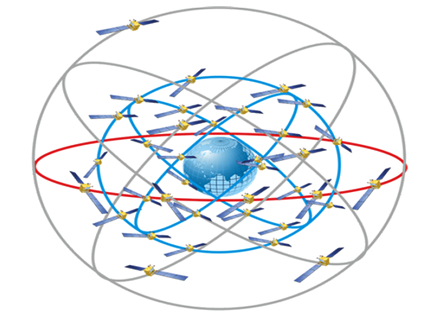
| Geostationary satellite | Number of satellites | 5 |
|---|---|---|
| Angle of inclination | 55° | |
| Altitude | 35,786km | |
| Medium Earth orbit satellite | Number of satellites | 27 |
| Angle of inclination | 55° | |
| Altitude | 21,528km | |
| Inclined-orbit geostationary satellite | Number of satellites | Worldwide service |
| Angle of inclination | 55° | |
| Altitude | 35,786km |
BeiDou's DGPS Frequency Band
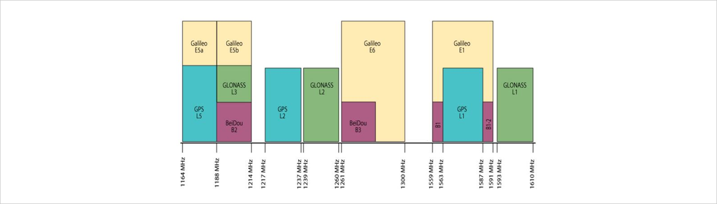
1164 MHz ~ 1188 MHz : GPS L5, Galileo E5a /
1188 MHz ~ 1214 MHz : BeiDou B2, GLONASS L3, Galileo E5b /
1217 MHz ~ 1237 MHz : GPS L2 /
1239 MHz ~ 1260 MHz : GLONASS L2 /
1261 MHz ~ 1300 MHz : BeiDou B3, Galiileo E6 /
1559 MHz ~ 1563 MHz : BeiDou B1 /
1563 MHz ~ 1587 MHz : GPS L1 /
1587 MHz ~ 1591 MHz : BeiDou B1-2 /
1559 MHz ~ 1591 MHz : Galileo E1 /
1593 MHz ~ 1610 MHz : GLONASS L1
| Satellite | Frequency |
|---|---|
| B1 | 1561.098 MHz |
| B1-2 | 1589.742 MHz |
| B2 | 1207.14 MHz |
| B3 | 1268.52 MHz |
BeiDou PROJECT
- China's BeiDou Project is promoted through a three-stage development strategy.
| Stage | Number of satellites | Target | Service |
|---|---|---|---|
| Stage 1 (BeiDou-1) | 3 | China and neighboring countries | 2000 ~ 2003 |
| Stage 2 (BeiDou-2) | 14 | China and neighboring countries | 2004 ~ 2012 |
| Stage 3 (BeiDou-3) | Over 35 | Worldwide service | 2009 ~ |
